BHUVAN APPLICATIONS & DATA
|
BHUVAN-NEWS-15-April-2026
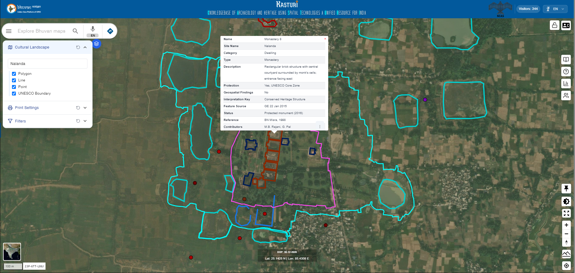
KASTURI
KASTURI (Knowledgebase of Archaeology and heritage using Spatial Technologies: a Unified Resource for India) is a geospatial heritage portal. It maps cultural features as points, lines, and polygons, offering detailed attributes, sources, and metadata. It helps researchers, planners, and the public explore heritage within its environmental and historical context. By making heritage visible at the landscape level, KASTURI supports informed decision-making, interdisciplinary research, and culturally sensitive development.
Visit
|
|
|
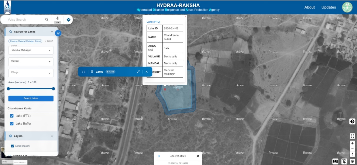
HYDRAA - RAKSHA
The HYDRAA-RAKSHA GIS provides comprehensive information on notified lakes, including approved documentation. It features high-resolution aerial imagery from 2006 alongside recent satellite images, and offers interactive tools for querying, visualizing, and exploring spatial data and associated documents.
|
|
|
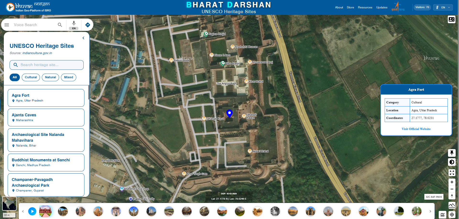
Bharat Darshan
The interactive platform that lets users explore India’s World Heritage Sites through an engaging map and list view. Visitors can follow a guided autoplay tour or click on individual sites to view details. Hovering over icons reveals site names, while the structured list enables easy navigation. Designed for education and cultural awareness, it showcases India’s rich heritage.
Visit
|
|
|
Bhuvan DIGIPIN
Bhuvan DIGIPIN a digital geocoding system developed to provide a unique, location-specific alphanumeric code for precise identification of geographic locations across India. DIGIPIN is designed to improve address standardization, enabling accurate location sharing for governance, emergency services, logistics, and digital applications. In Bhuvan portal this DIGIPIN would be available in bottom left corner on map hover as well as on enabling the DIGIPIN button and then clicking on the map. Besides this user can serach by adding DIGIPIN in Bhuvan searchbar.
Visit
|
|
|
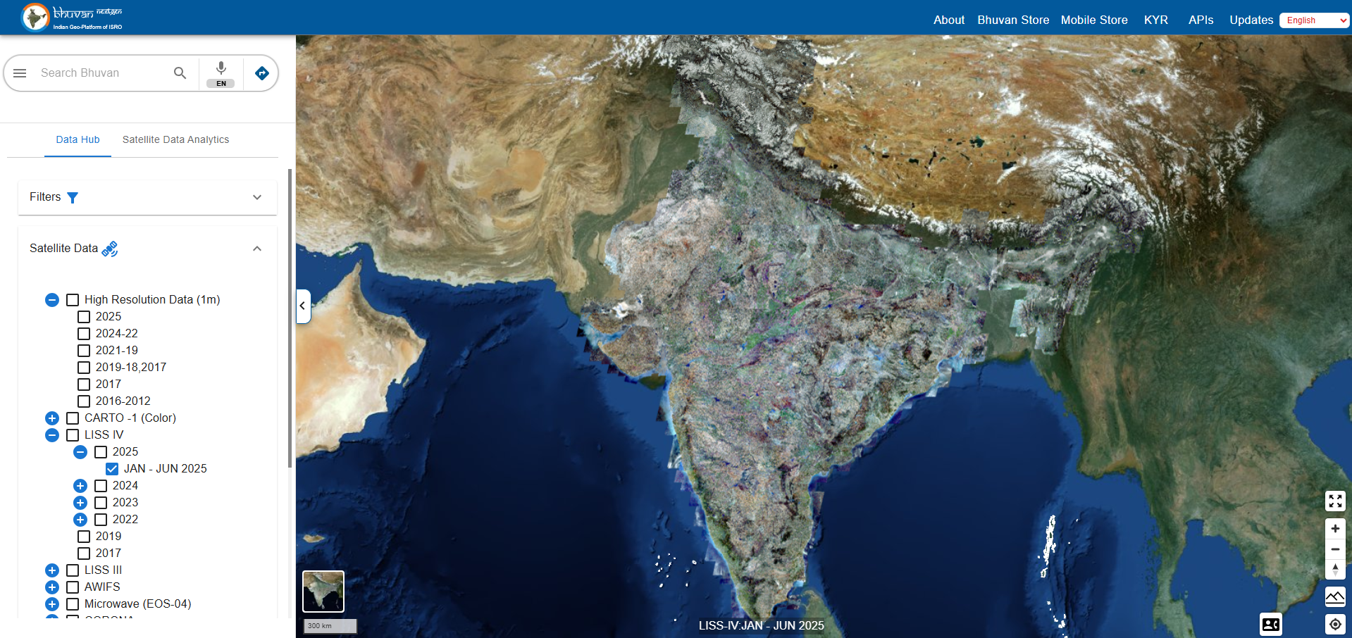
Bhuvan Data update (EOS, AWIFS, LISS III)
Bhuvan has been updated with the latest datasets, including latest high resolution imagery, EOS satellite data, AWiFS imagery, and LISS-III data. This enhancement provides users with more accurate and up-to-date information for applications in agriculture, urban planning, disaster management, and environmental monitoring
Visit
|
|
|
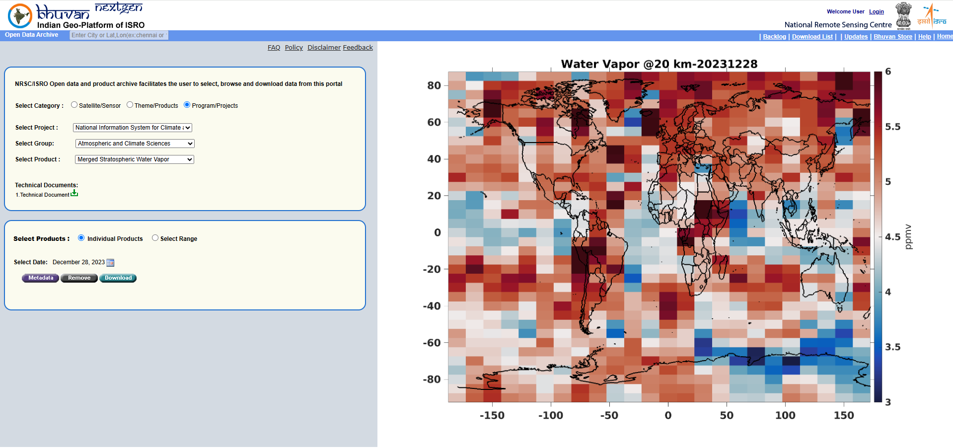
Merged Stratospheric Water Vapour
National Information System for Climate and Environment Studies is updated with new product Merged Stratospheric Water Vapour under Atmospheric and Climate Sciences Products from January 2002 to December 2023. The datasets can be visualized and downloaded here
Visit
|
|
|
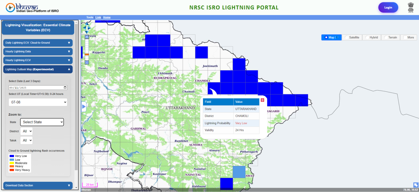
Lightning Outlook Map (Experimental)
An experimental Lightning Outlook Map providing a 3-hour forecast has been integrated into the NRSC–ISRO Lightning Portal to support preparedness and early risk awareness. The map operates on a 15 km grid resolution and allows users to explore data across state, district, taluk, and even down to the village level, offering highly localized insights. The tool displays lightning probability ranging from very low to very high. This classification enables easy interpretation of risk levels and supports timely decision-making by the public, local authorities, and disaster management agencies.
Visit
|
|
|
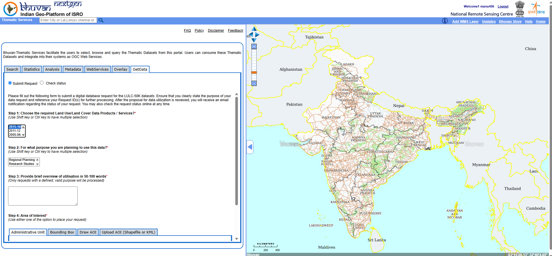
LULC -50K Data Download
As per the National Geospatial Policy-2022, users can now download LULC 1:50K datasets in shapefile format for the years 2015–16, 2011–12, and 2005–06. Data can be requested by selecting up to five districts, drawing an Area of Interest (AOI) or bounding box, or by uploading an AOI in shapefile or KML format. Users are required to specify the purpose of utilization while submitting their request. Once approved, the download link is shared with users via their registered email, ensuring a streamlined and user-friendly data access process.
Visit
|
|
|
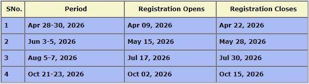
Webinar on Bhuvan Overview Training
Bhuvan Webinar based Training offered on Bhuvan Visualization, Services and Collaborative Applications. The training is aimed for student participants from fields like Computer Science, Geo-informatics, Civil Engineering, Remote Sensing, Geology and Geography Departments and participants from various Government organizations and varied professions. Please register here to participate in the training.
Visit
|
|
|
|
|