
Bhuvan Updates
| BHUVAN-NEWS-12Jun2013 | |
|
Ancient Nalanda on Bhuvan now Nalanda is primarily a archaeological site exposed during the excavations conducted by Archaeological Survey of India during 1915-37 and 1974-82. It is said that the city was spread over an area of sixteen square kilometers of which only an area of around square kilometer is excavated. The extensive remains are of brick temples and eleven monasteries arranged on a systematic layout. Visit on Bhuvan. more More. 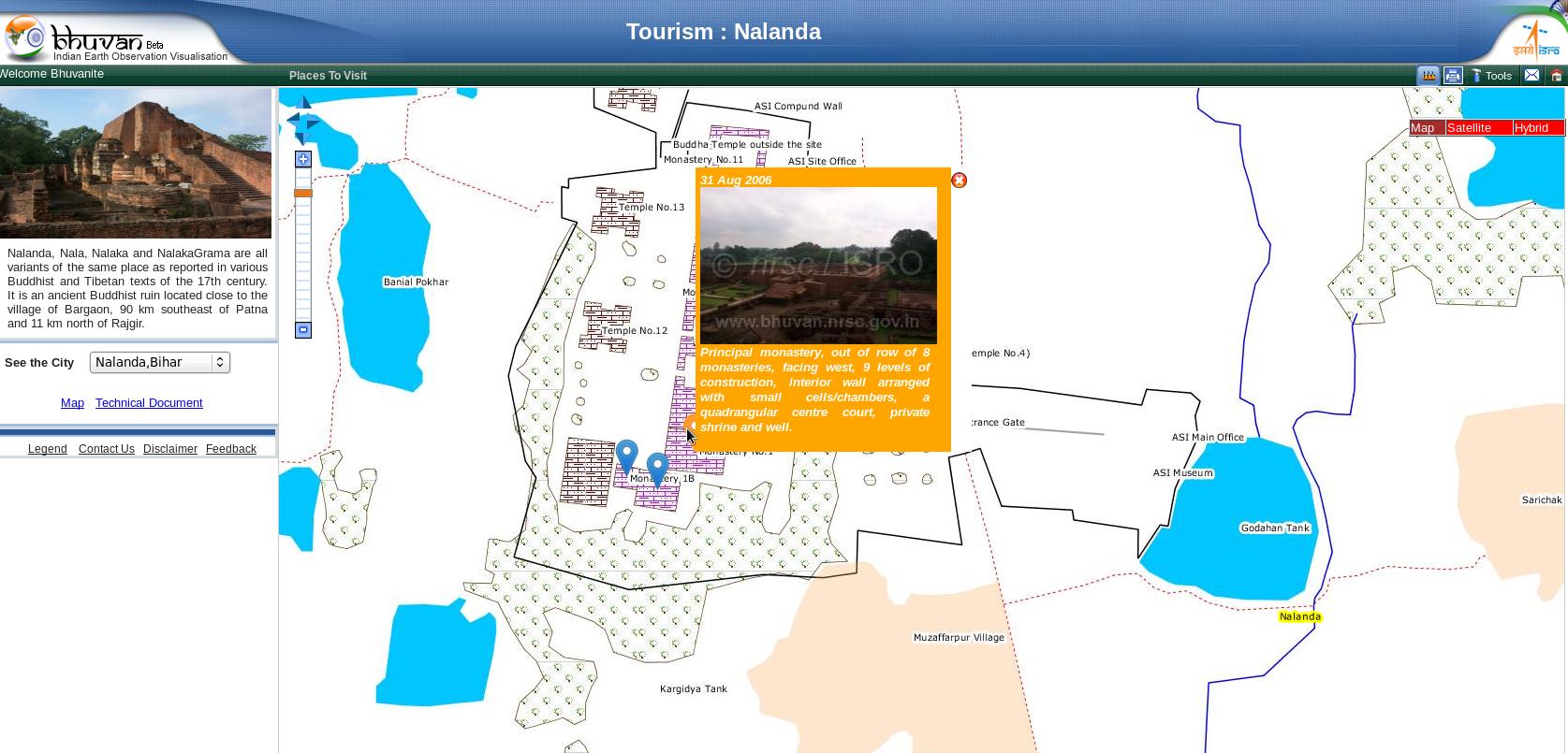 |
Landuse landcover maps updated The landuse maps of 155 districts, prepared from satellite data 2011-12 are presented on Bhuvan. This adds to the previous release of 2005-06 maps. Have a look and take a printout of your view, embed these maps in your websites. Field photographs are the added feature in this release. More. 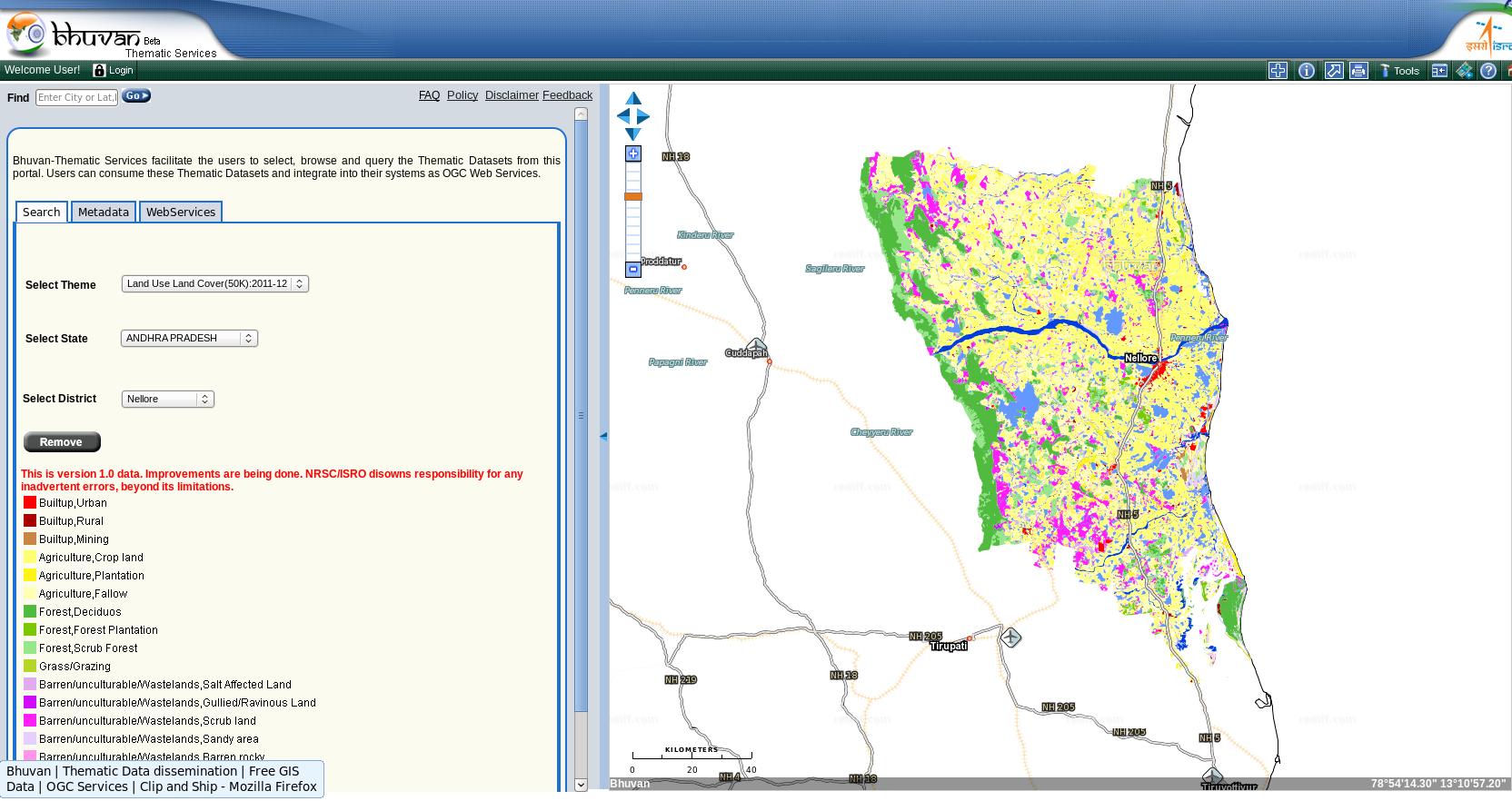 |
|
Amarnath Pilgrimage : The landslide inventory map Amarnath cave is a very famous dedicated to Lord Shiva. The cave situated at an altitude of 3,888 m is surrounded by snowy mountains. An annual pilgrimage is made to the Amarnath cave by lakhs of devotees on challenging mountainous terrain to see an ice stalagmite formed inside the cave. The landslide inventory map for Amarnath pilgrimage is made available to Bhuvanites under Route –wse inventory of Landslide Disaster services with detail technical report. More 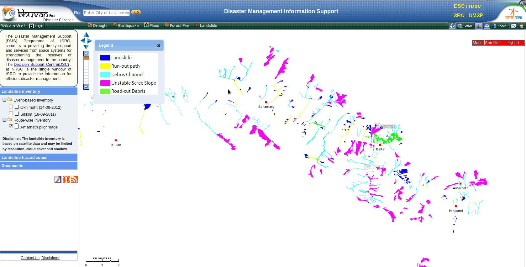 |
Urban Sprawl dynamics of Cities Urban sprawl refers to the extent of urbanisation, which is a global phenomenon mainly driven by population growth and large scale migration. The information related to the rate of growth, pattern and extent of sprawl helps for better management of amenities such as water, sanitation, electricity, etc. The multi-date satellite view has picked up urban spral dynamics of Coimbtore, Cochin, Mysore cities. Visit Bhuvan to have a glimpse of it. More. 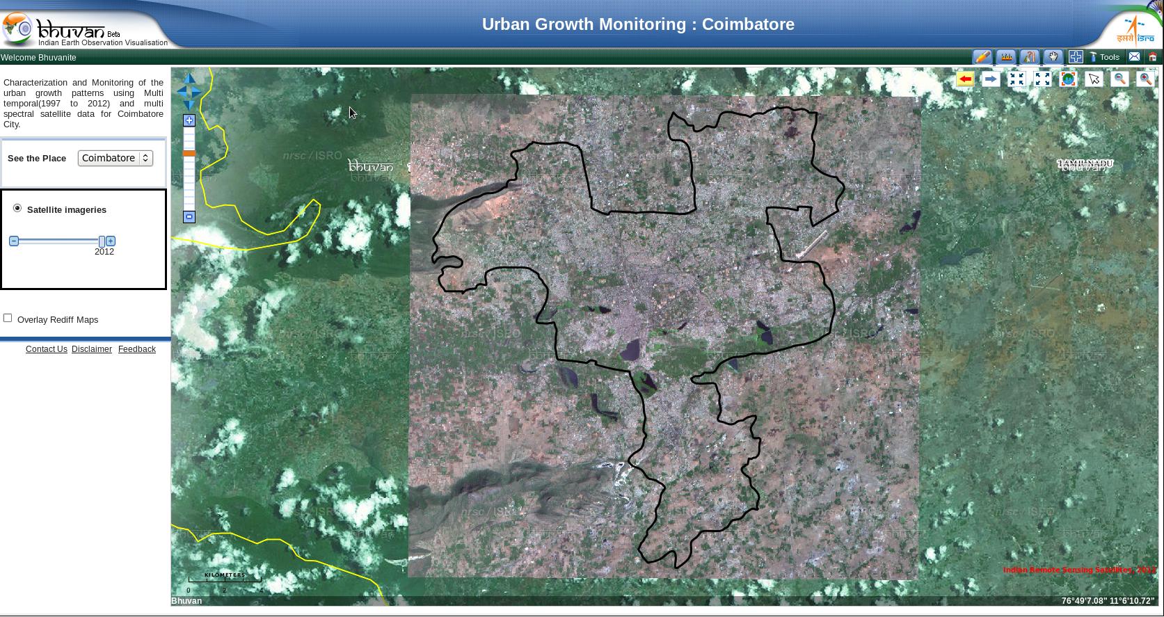 |
Visit Bhuvan at https://bhuvan.nrsc.gov.in
Please feel free to write to us at bhuvan[at]nrsc[dot]gov[dot]in for any queries/feedback on Bhuvan or if you wish to unsubscribe from Bhuvan Updates.