alt_text alt_text
 

BHUVAN APPLICATIONS & DATA


BHUVAN-NEWS-14-AUG-2023

Irrigation

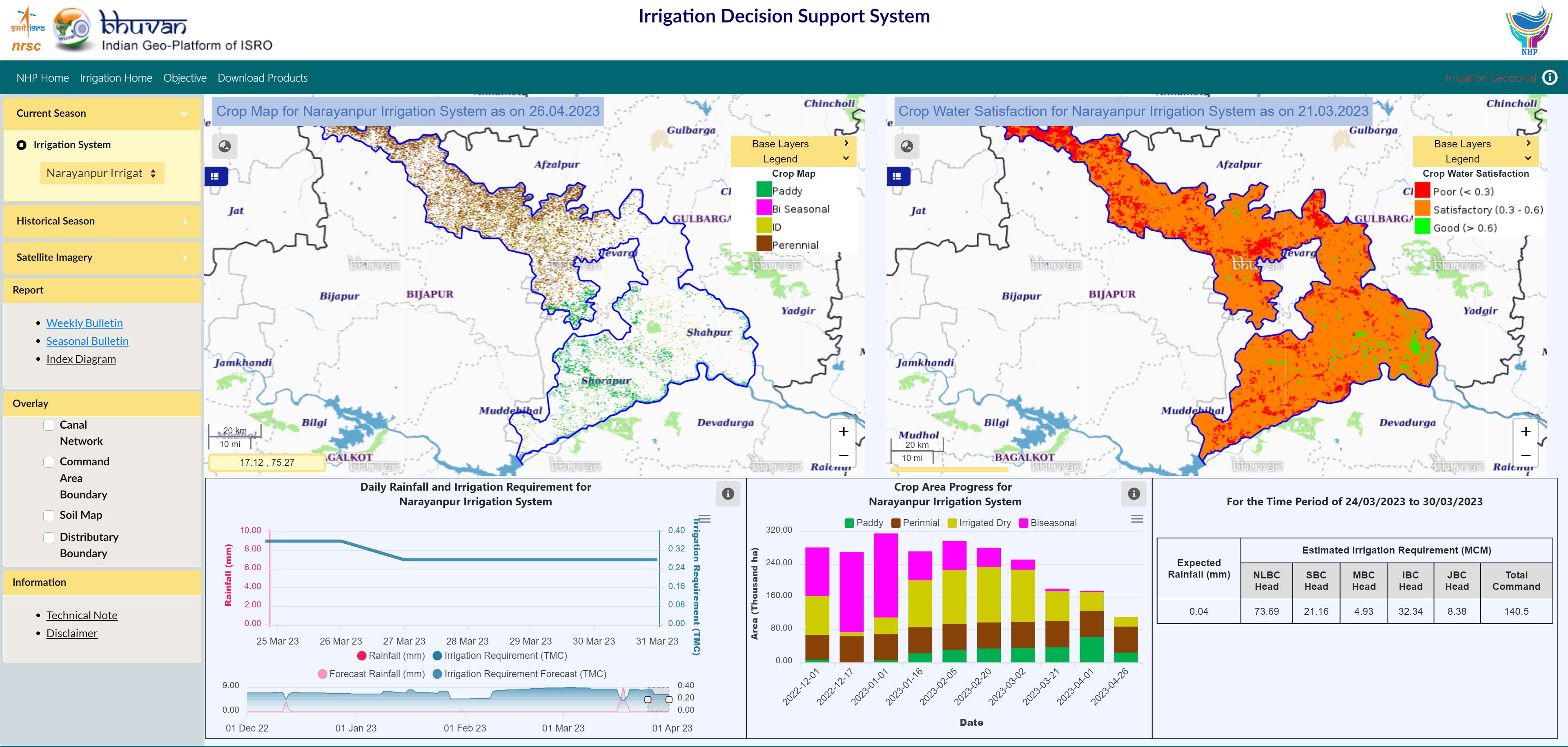
Irrigation Decision Support System in National Hydrology Project (NHP)

Irrigation Decision Support System showcases the geospatial database of the Narayanpur Irrigation System in Karnataka, including command area map, canal network, satellite imagery, crop map, crop condition and irrigation requirements. It is expected to support efficient irrigation water management through generation of advisories on actual irrigation demand based on near real time satellite data derived inputs.


WBIS

Updates to Water Body Information System

Water Body Information System (WBIS) has been updated with Water Spread Meter, EAC Generation and Regional Analytics modules. Regional Analytics provides the current and historic water spread dynamics of the selected region. EAC Generation module provides the facility to generate the Elevation-Area-Capacity curves for selected reservoirs.


FEWS

Flood Early Warning System

Flood Early Warning System has been updated with rainfall information along with hydrograph, reservoir water level, inflow and volume information and six hourly inundation simulations for Godavari and Tapi basins.


Flood Animation

Flood Events Animation

Flood Event Animation portal provides an interactive visualisation of simulated inundated map of recent flood events based on selected date in Godavari and Tapi basins.


For More Latest Updates Visit @ Bhuvan


Please feel free to write to us at bhuvan[at]nrsc[dot]gov[dot]in for any queries/feedback on Bhuvan or if you wish to unsubscribe from Bhuvan Updates.