alt_text alt_text
 

BHUVAN APPLICATIONS & DATA


BHUVAN-NEWS-07-JAN-2025


bhuvannextgen

Bhuvan NextGen

Bhuvan, the Indian Geo-portal of ISRO, provides a platform to visualize remote sensing & thematic datasets, and allows government departments to host customized applications to enable effective G-governance. Bhuvan NextGen has been designed to address a diverse range of societal needs through continuous innovation and a user-centric approach. It consolidates relevant data into a single gateway, facilitating access through 5 distinct modes: standard, thematic, scientific, governance and disaster mode.


grow

Greening and Restoration of Wastelands with Agroforestry (GROW):

Greening and Restoration of Wasteland with Agroforestry (GROW) report and portal was launched by NITI Aayog on 12 Feb 2024. The Greening and Restoration of Wasteland with Agroforestry (GROW)-Suitability Mapping portal allows universal access to state and district-level data. Currently, agroforestry covers 8.65% of India's total geographical area, totalling about 28.42 million hectares. Current report underscores the potential benefits of converting underutilized areas, especially wastelands, for agroforestry. The GROW initiative aligns with national commitments, aiming to restore 26 million hectares of degraded land by 2030 and create an additional carbon sink of 2.5 to 3 billion tonnes of carbon dioxide equivalent


jjm2

Bhuvan Urban Water Information System

The Bhuvan Urban Water Information System (UWIS) is a decision-support platform developed under the Atal Mission for Rejuvenation and Urban Transformation (AMRUT) for Ministry of Housing and Urban Affairs (MoHUA). The dashboard portal contains detailed information of urban water bodies for 500 AMRUT cities and associated aquifers for 10 cities as pilot study. Users (MoHUA) can visualize various aspects of the urban water bodies (temporal water spread, quality, land-use change etc.) along with characteristics of urban aquifer (ground water prospects, seasonal ground water quality & water level fluctuation, aquifer health-sustainability etc).


jjm2

Latest High Resolution Data Update - Cartosat-2S satellite

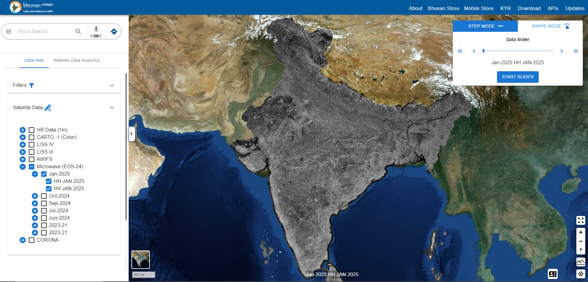
A new high-resolution country mosaic of the Indian region has been created using multispectral satellite data from the Indian Remote Sensing (IRS) Cartosat-2E, 2C, 2D, and 2F satellites, and has been updated on the Bhuvan EO portal. The images were acquired between 2024 and 2022. The data has been orthorectified, achieving a planimetric accuracy of approximately CE90 5m, and processed at a spatial resolution of 1.5m. This country-level mosaic prepared using about 40,000 scenes, is in Natural Colour Composite (NCC), with contrast enhancement and radiometric balancing applied. The data can be accessed on the Bhuvan EO portal through the "Data Hub" mode by selecting "HR Data (1m)" and the "2024-22" checkbox.


Webinar

Webinar on Bhuvan Overview Training (2025)

Bhuvan Webinar based Training offered on Bhuvan Visualization, Services and Collaborative Applications. The training is aimed for student participants from fields like Computer Science, Geo-informatics, Civil Engineering, Remote Sensing, Geology and Geography Departments and participants from various Government organizations and varied professions. Please register here to participate in the training.


For More Latest Updates Visit @ Bhuvan


Please feel free to write to us at bhuvan[at]nrsc[dot]gov[dot]in for any queries/feedback on Bhuvan or if you wish to unsubscribe from Bhuvan Updates.