
Bhuvan Updates
| BHUVAN-NEWS-08 OCTOBER 2014 | |
|
Open Data Archive-Mesoscale compatible Inputs IRS-P6 AWiFS derived gridded land use/land cover (LU/LC) data over Indian region as input to mesoscale models (MM5 and WRF). IRSP6 AWiFS derived LU/LC data with 56m basic resolution has been scaled to 5, 2 minute & 30 second resolutions. Indian region of USGS data is replaced with AWiFS derived data and made compatible to MM5 and WRF model. The resultant product is a global USGS LU/LC data with the Indian region replaced by the 56m resolution AWiFS based LU/LC adopted for mesoscale models, which is more accurate and updated at annual basis for the time period 2004-2005 to 2012-2013 (9 Cycles). 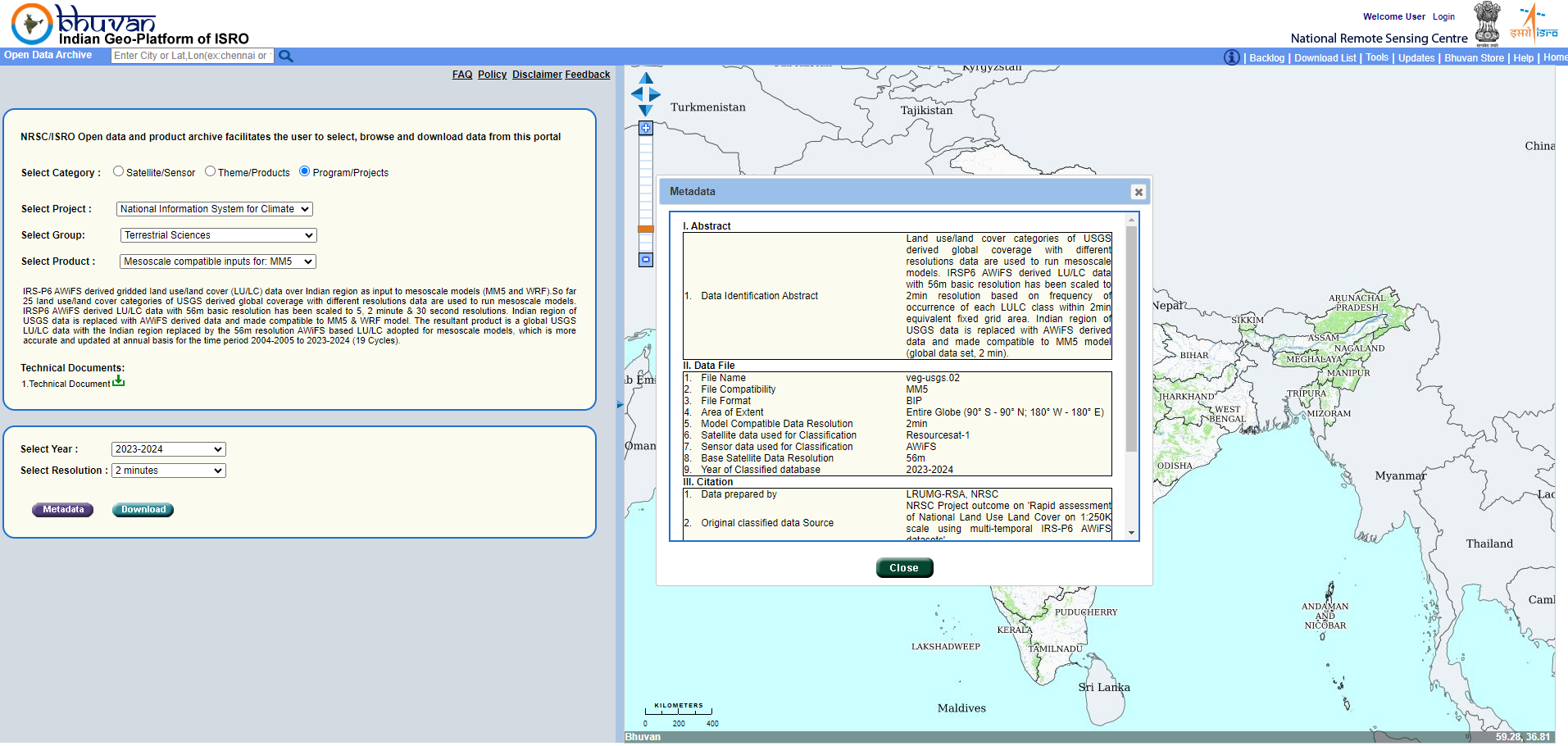
|
OCM: Surface Water Layer Products - 2 day repetitivity Oceansat-2 water layer products version 1.0 derived from the data acquired by Ocean Color Monitor (OCM2) sensor. The spectral absorption characteristic of water in the visible and NIR bands together with the normalized indices such as NDVI, NDWI (Mc Feeters, 1996) are used for the extraction of water features from OCM imagery. Knowledge map in the form LULC maps are further used to assist the classification of water features. Visit 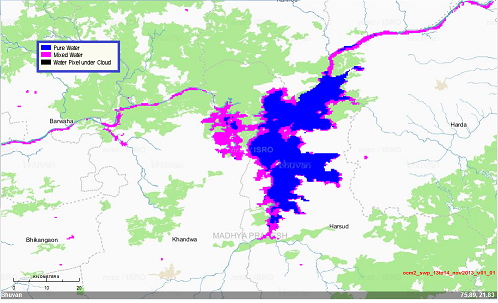
|
|
Bhuvan Services for Odisha Enabling State Portals for Geo-Governence by providing all available Information on Administrative layers, Agriculture & Soil, Disaster Specific datasets, Geology & Mines, Landuse Landcover, Urban etc Visit 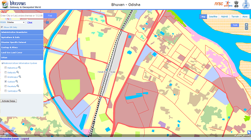
|
Bhuvan Services for Punjab Information on Administrative layers, Agriculture & Soil, Census Data, Disaster Specific datasets, Geology & Mines, Ground Water, Irrigation, Landuse Landcover, Tourism, Urban, Water Resources etc.Visit 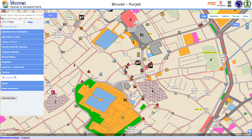
|
Visit Bhuvan at https://bhuvan.nrsc.gov.in
Please feel free to write to us at bhuvan[at]nrsc[dot]gov[dot]in for any queries/feedback on Bhuvan or if you wish to unsubscribe from Bhuvan Updates.