NHP- National Evaporative Flux Monitoring System portal has been updated with Monthly and Fortnightly ET data sets. Monthly and Fortnightly data has been updated from January 2019.
Temporal dynamics of Asset creation under Geo-MGNREGA has been updated in public domain. Users can check the monthly trends of asset creation under Geo-MGNREGA in each grid either as a bar or line graph.
Scientific rule sets based on LULC, Slope, Soil and DEM data are integrated to provide probable locations for the planning of selected category and sub-categories in the panchayat level. The data has been currently integrated for Gulbarga district of Karnataka.
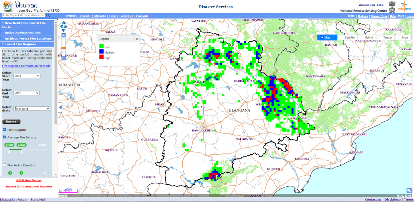
Forest Fire Regimes have been updated with data from 2013 to 2021 to calculate forest fire zonation across India and states to calculate Fire regimes, Average Fire Density, Fire Period Duration and Standard Deviation of Average Fire Density. Users can interactively alter the thresholds to generate updated grids for forest fire regimes.
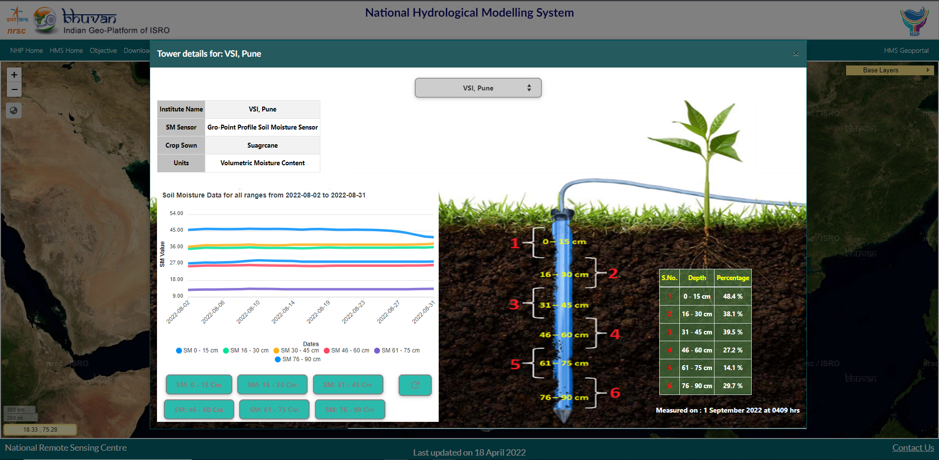
Soil moisture information for multiple depths ranging from 0 cm to 90 cms below ground level collected in near real time from 10 flux towers across India every 30 minutes. Graphical visualization of the average soil moisture data for last 30 days.