|
BHUVAN-NEWS-04 Feb 2020 |
Planning Portal
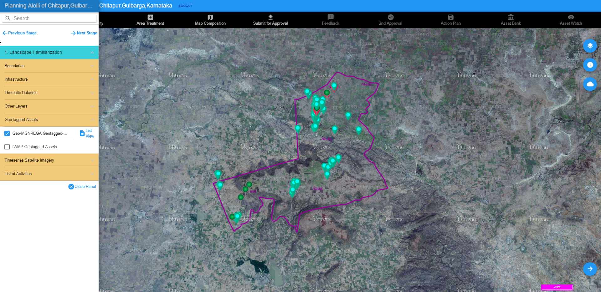
Geospatial Planning portal for Geo-MGNREGA to generate an approved plan of action for initiating activity at any given location.
Visit
|
 |
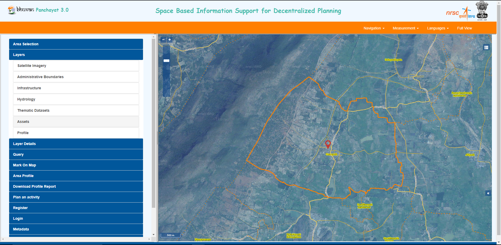
Bhuvan Panchayat
Decentralised planning platform to help citizen and gram panchayats to plan activities in their panchayat with the help of various geospatial datasets.
Visit
|
 |
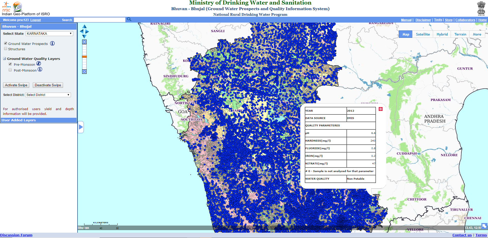
Ground Water Quality
Habitation wise Ground Water Quality (point) information (potable & non-potable) for the users to visualise.
Visit
|
 |
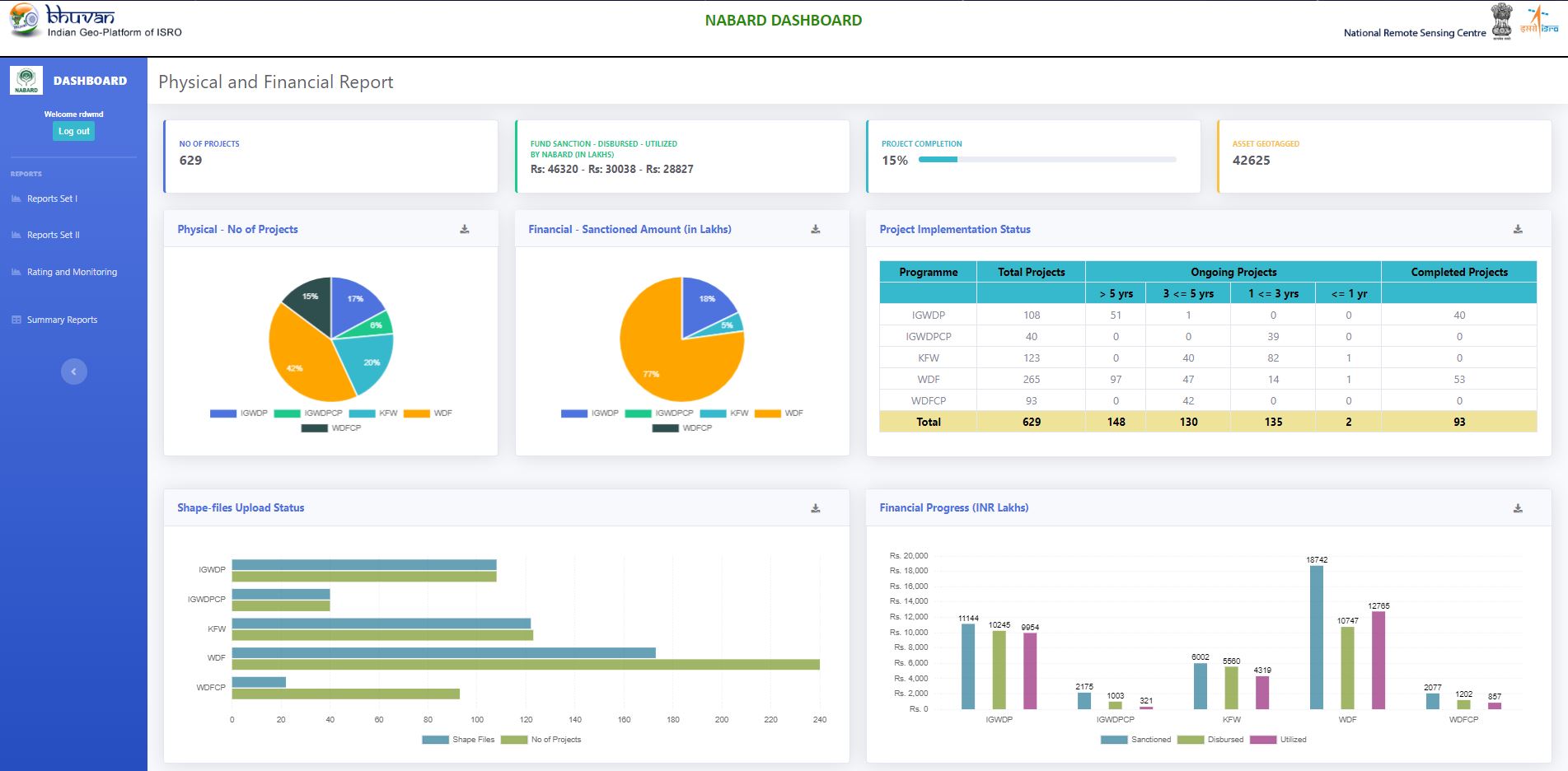
Bhuvan NABARD
Monitoring of NABARD Watershed Projects (phase 2) includes analytical tools like dashboard, new moderation form, rating and monitoring mechanism with quarterly, half-yearly and yearly report generation. Visit
|
 |
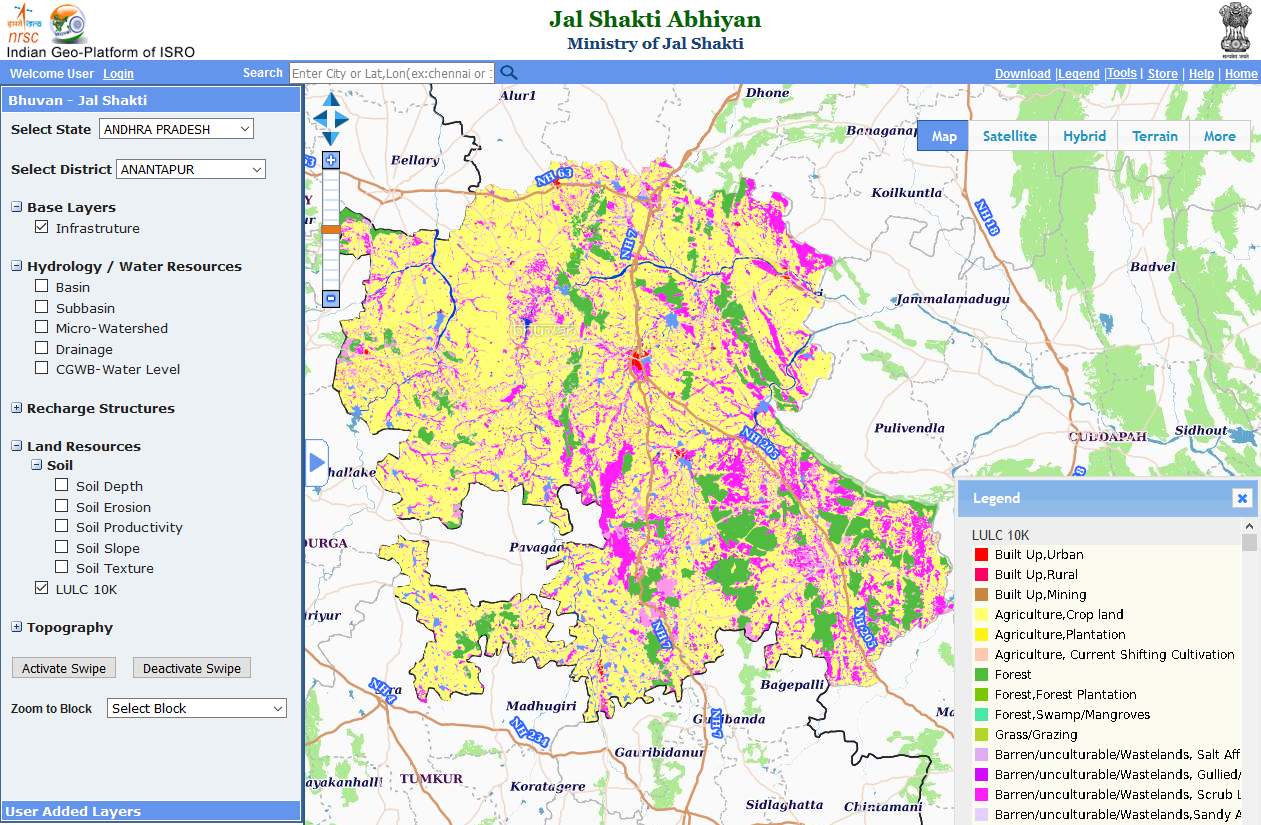
Bhuvan-Jal Shakti Abhiyan
Application envisaged to support Jal Shakti Abhiyan provides visualization of rich thematic data sets and water conservation assets for the identified Districts and Blocks across the country. Visit
|
 |
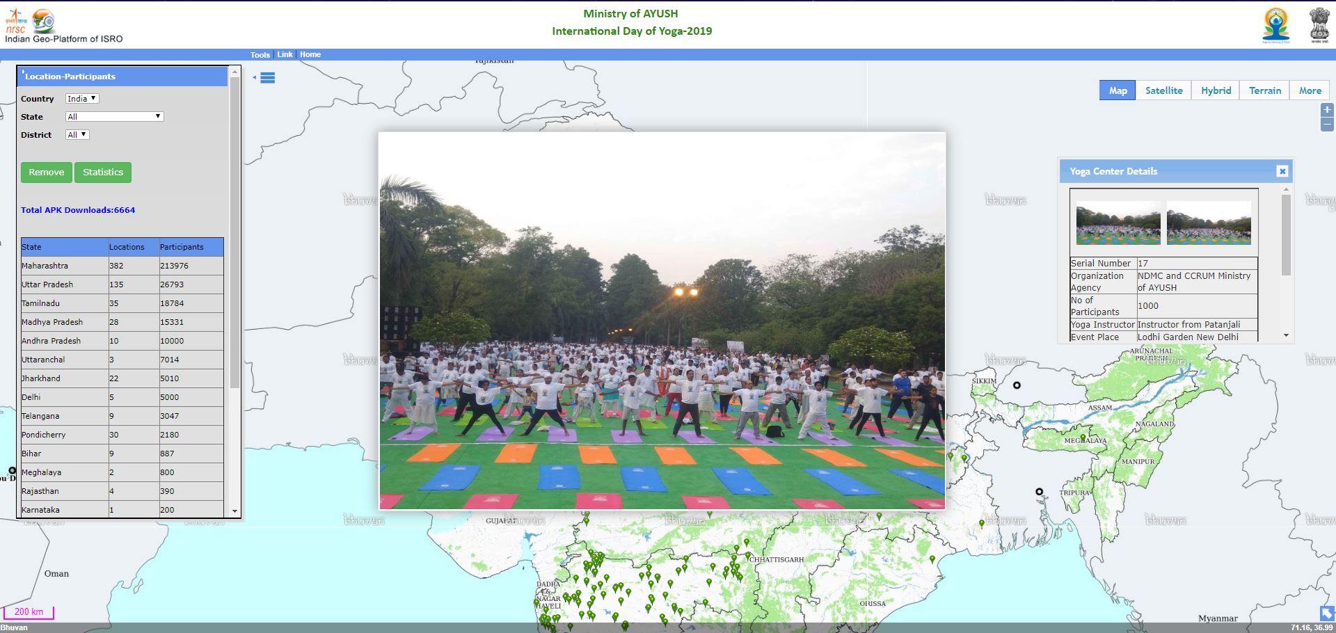
Bhuvan Yoga Day
Android mobile app and web portal for crowd-sourced real time data and visualization through the geospatial platform with spatial intelligence. Visit
|
 |
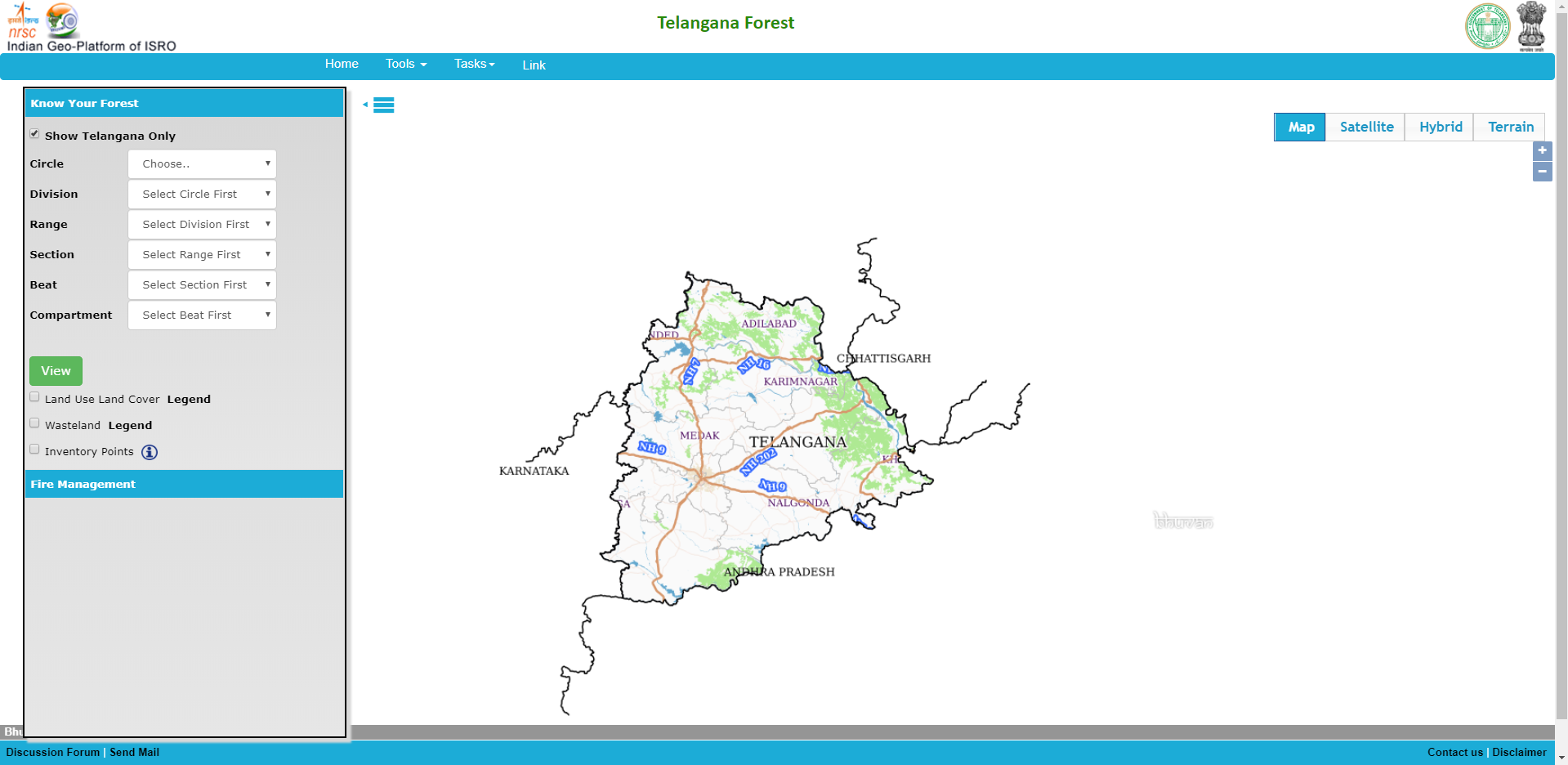
Forestry
Near real time Forest Fire Alerts with beat level information. Telangana Forest Punjab Forest
|
 |
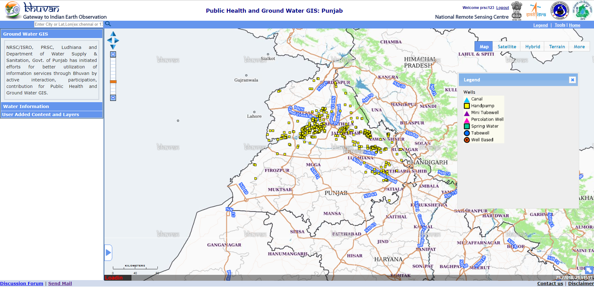
Public Health and Ground Water GIS - Punjab
Information services through Bhuvan by active interaction, participation, contribution for Public Health and Ground Water GIS. Visit
|
 |
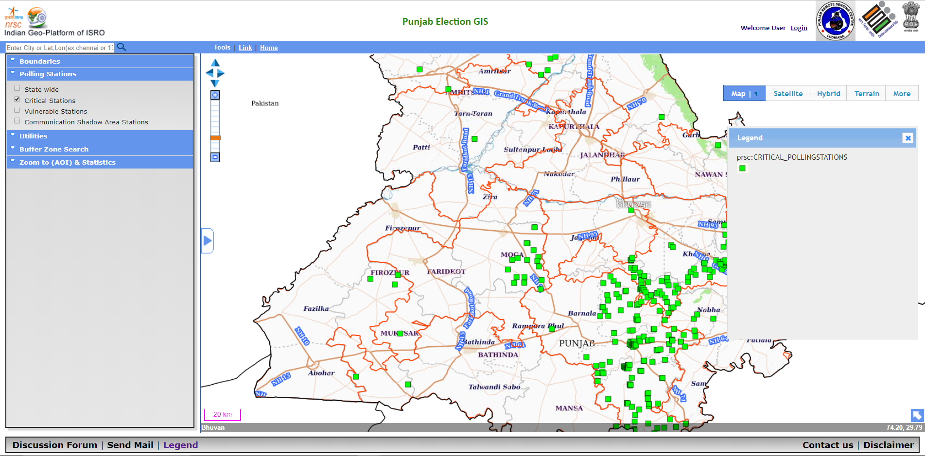
Election GIS - Punjab
Information including parliamentary & assembly constituency boundary, polling stations, availability of Ambulances etc. through Election GIS for the state of Punjab. Visit
|
 |
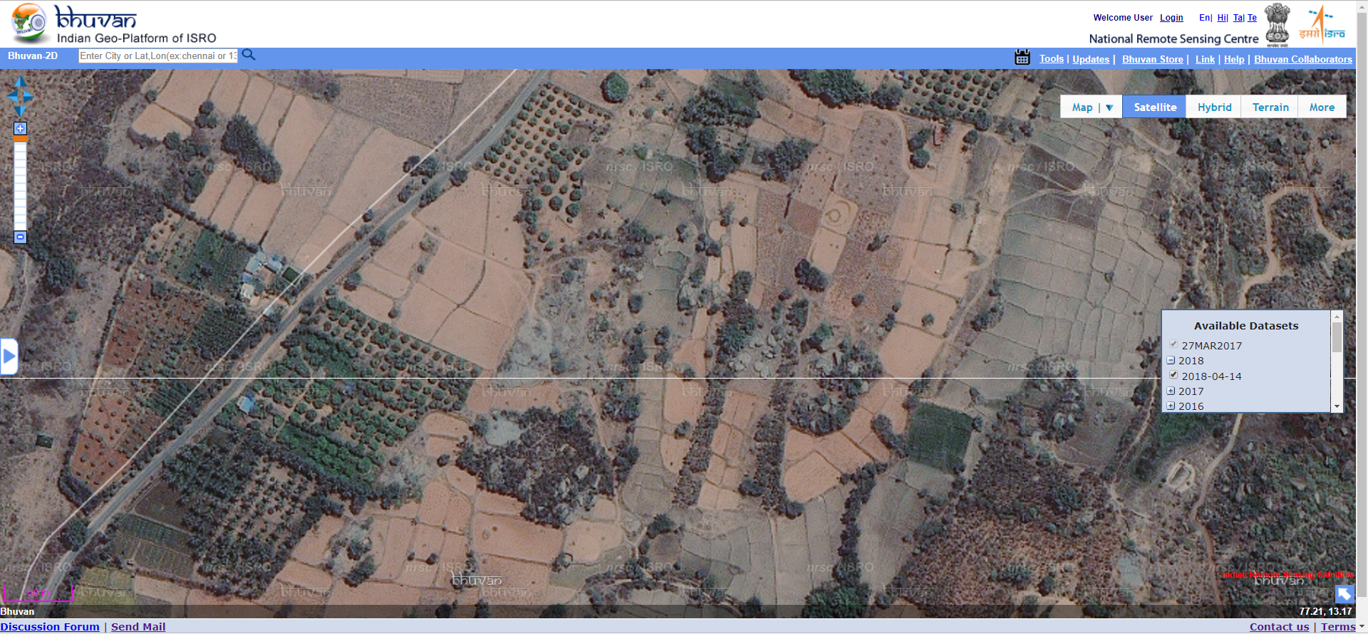
Bhuvan 2D
Enriched Bhuvan -2D with High Resolution Satellite data of year 2018 with temporal datasets for visualization. Visit
|
 |
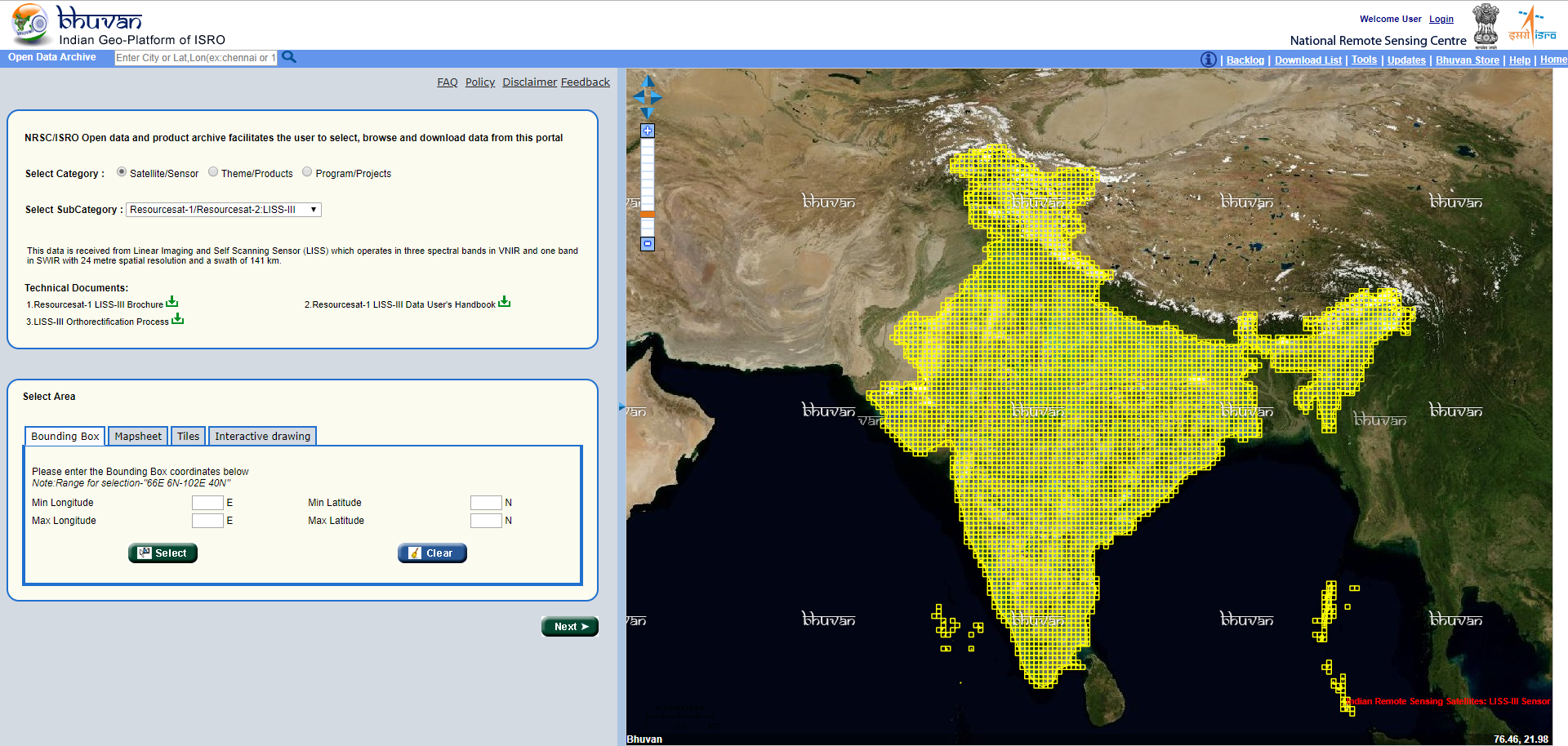
Open Data Archive
Addition of 2017 LISS III and AWiFS Datasets for download in NRSC Open EO Data Archive.
|
 |
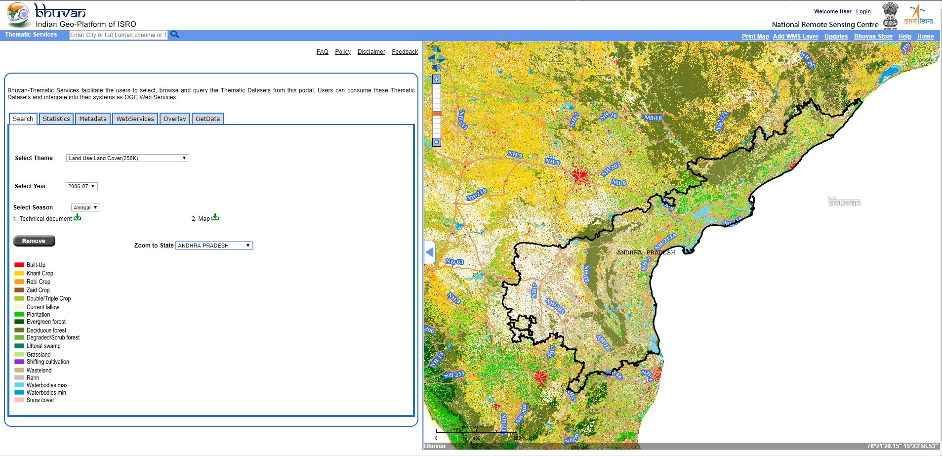
Thematic Services
Enhanced Thematic Services with new datasets LULC 50K 2015-16 (PAN India), LULC 250K - Annual, Rabi and Kharif (till 2018-19). Visit
|
 |
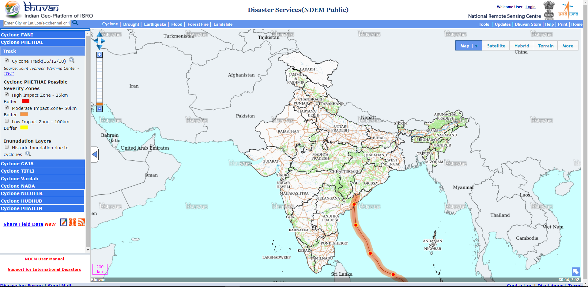
Disaster Services
Constant support for several natural disasters including cyclones Phethai and Fani. Visit
|
 |
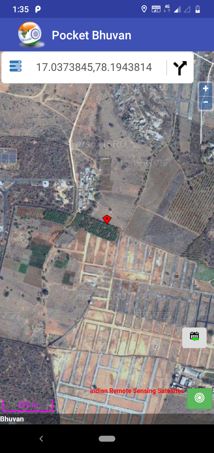
Pocket Bhuvan
Offline caching facility having visualization of High Resolution satellite data and rich Point of Interest data. APK for Mobile app
|
 |
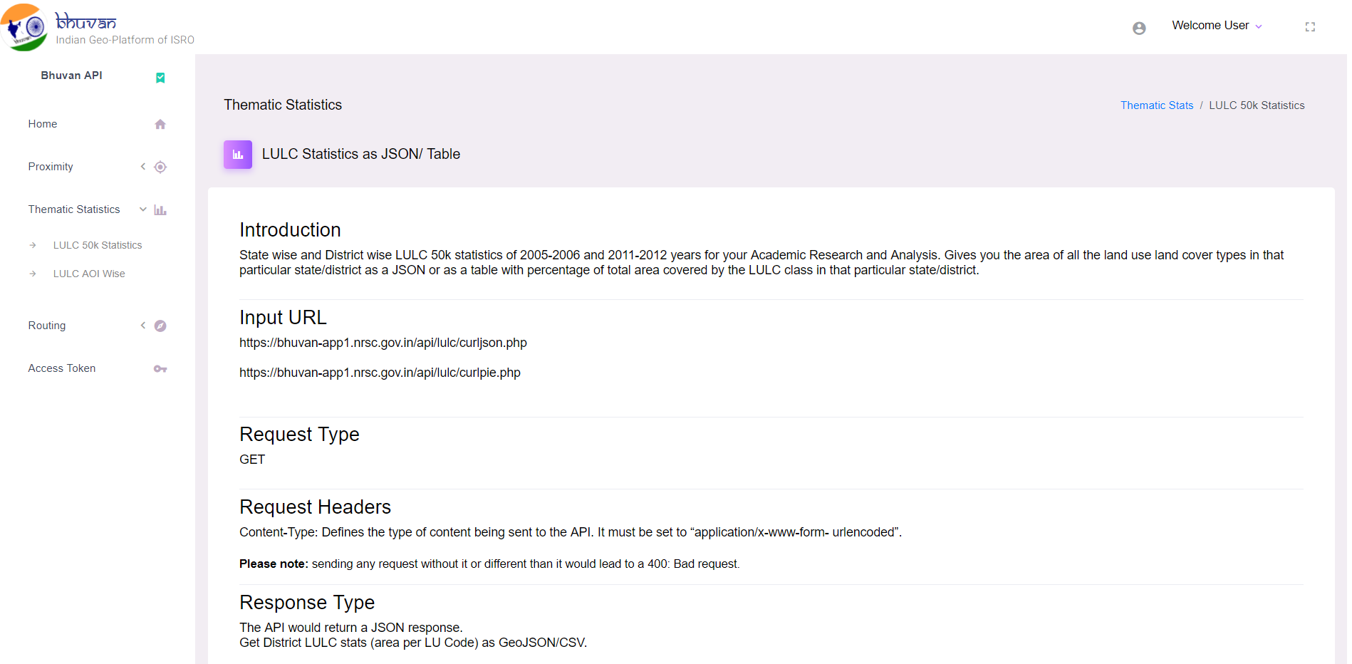
Bhuvan API
Geocoding, Reverse Geocoding, Search, Land Use and Land Cover statistics and Routing APIs for developers.
|
 |
