Difference between revisions of "Atmospheric and Climate Sciences Products"
Bhuvan Admin (talk | contribs) |
Bhuvan Admin (talk | contribs) |
||
| Line 1: | Line 1: | ||
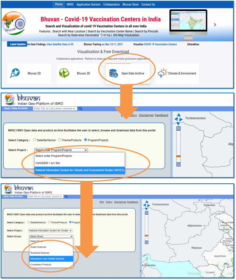
| + | [[File:NICESS.png|link=|border|950px|]] | ||
| + | |||
== Cloud Fraction and Cloud Cover == | == Cloud Fraction and Cloud Cover == | ||
<div style="text-align:justify"> | <div style="text-align:justify"> | ||
Latest revision as of 11:14, 19 March 2021
Cloud Fraction and Cloud Cover
Cloud Fraction is derived from the cloud cover product generated using the radiance and reflectance measurements from the thermal infrared and visible channels respectively along with water vapour channel from Very High Resolution Radiometer (VHRR) onboard Indian Geo-Stationary Satellite INSAT-3D.
Derived Tropospheric Ozone
Tropospheric Ozone product is derived from OMI (Ozone Monitoring Instrument ) adnd MLS (Aura Mcrowabe Limb Sounder) instrument to study Columner topshperic ozone
Planetary Boundary Layer Height
Planetary Boundary Layer Height (PBLH) over the Indian land mass is estimated using vertical profiles of temperature and relative humidity from Cross track Infrared Sounder (CrIS) onboard Suomi-NPP, through integration of five different methods.
| S.No. | Product | Resolution | Data Availability | Frequency | CoverageTile Extent/Spatial Extent | File Size/Download (approx.) |
|---|---|---|---|---|---|---|
| 1 | Cloud Fraction and Cloud Cover | 0.10° x 0.10° , 0.25° x 0.25° | 01-Sep-2008 19-Oct-2020 | Half-Hourly | Indian Sub-continent (-10° - 45.5° N; 44.5° E - 105.5° E) | 2 - 4MB |
| 2 | Derived Tropospheric Ozone | 1° x 1° | 01-Jan-2010 16-Jan-2021 | Daily | 0° - 40° N; 60° E - 100° E | 500KB |
| 3 | Planetary Boundary Layer Height (Daily, 7 Day, Monthly) | 0.25° x 0.25° | 01-Sep-2014 01-Jan-2021 | Daily | 05° - 40° N; 50° E - 110° E 200 - | 300KB |